information about altocumulus clouds
Information about Altocumulus Clouds
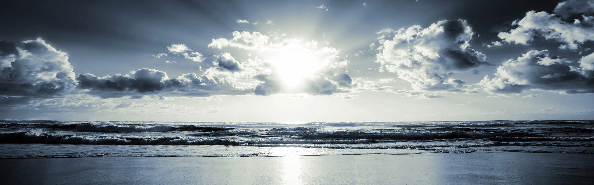
Altocumulus clouds are middle-level clouds that form at a height of around 6,500 to 20,000 feet above the sea level. This Buzzle article gives you some interesting facts about these clouds and their varied types.
Varieties
Altocumulus Radiatus
▸ They appear as parallel bands of clouds. They usually have a main body from which wisps of the cloud radiate.
▸ They are formed when air with moisture is forced to move to the upper atmosphere. Here, the cold air forces the liquid within the air to condense, forming particles that make the clouds.
▸ They are formed at a height between 6,000 and 16,000 feet above sea level.
▸ Clouds with tiny droplets of water or ice within them disperse light. This means that the clouds will appear dark. Clouds with larger droplets will allow more light to pass through. Hence they will look whiter than those with smaller droplets.
▸ The color of these clouds is either white or gray.
▸ These clouds are very common. They are mostly seen in the temperate zones.
▸ These clouds cause frosting on the wings and other parts of planes. This is because they normally contain a large amount of moisture in the form of ice, water, or snow.
Altocumulus Perlucidus
▸ These clouds appear irregular and are commonly seen as lumps in the sky. There seem to be small gaps in these clouds.
▸ For these clouds to form, a mass of air at the ground level needs to have some moisture content. This could be through evaporation when the sun heats up the ground, or it could be when the air mass flows over a water body, accumulating water as it travels over it. These clouds are generally formed in the same way as other clouds. Cold air combining with moist air or a mountain causing air to move up due to conventional currents can lead to the formation of these clouds.
▸ They form at a height between 6,000 and 16,000 feet.
▸ These clouds are commonly seen in the temperate zones. However, they are very volatile i.e. they form and dissipate soon.
▸ These clouds can cause mechanical problems in the airplanes that fly through them.
Altocumulus Duplicatus
▸ These clouds are formed in two or several layers lying one above the other.
▸ They are formed by the accumulation of water droplets combining with warm air.
▸ These clouds are not easily spotted. It is relatively easy to see the lower layer as it is of a darker shade than the upper ones. The top layer is not easily seen. However, at sunset, when the sun is the lowest in the sky, the layering of these clouds is more visible.
▸ They are formed at a height of 6,500 feet and more, but not above 16,000 feet.
▸ They can be seen in all parts of the world.
▸ They are formed by the combination of water droplets and warm air.
Altocumulus Undulatus
▸ These clouds appear as gently rolling waves or ripples of water in the sky. The undulating bases of these clouds are due to the eddies at their base, thus creating wave-like patterns.
▸ They are formed just like any other clouds. The moisture content in air at the ground can be acquired on moving over a large water body, or due to the vapor of surface water.
▸ They form at a height between 6,000 and 20,000 feet above the sea level.
▸ They are made up of water, ice, or snow.
▸ They are white or gray in color and are around 300 feet thick.
▸ The formation of these clouds indicates that there is no risk of storm or heavy rains. They bring light rain.
▸ They are visible all through the year.
Altocumulus Translucidus
▸ These clouds appear as a screen in the sky. They are flat and resemble a translucent sheet of glass across the sky.
▸ As they are translucent, they allow sunlight or moonlight to be visible from behind them.
▸ They are formed by the transfer of heat between the warm air and water drops or ice crystals, depending on the height at which they are formed.
▸ These clouds form at a height between 6,500 and 20,000 feet.
▸ They do not indicate rainfall, but indicate precipitation in the next 10 to 20 hours from the time they are visible.
▸ They are fairly common and clearly visible in the sky.
▸ These clouds are very common and are seen everywhere in the world.
Altocumulus Lacunosus
▸ They appear as thin clouds with perforations in them. In Latin, lacunosus means 'full of holes'. These clouds look like a loose honeycomb with rough holes between the clouds. Holes appear along the boundaries of these clouds.
▸ These clouds are formed due to the sinking pockets of air that exist and which result in the formation of holes in the clouds. The cloud fringes are formed by the air coming up between the holes in the clouds.
▸ They form at a height of 6,500 to 13,000 feet.
▸ They are less common and are most visible during the summer season in certain countries. They are more often visible all through the year in countries that have a tropical climate. However, in some parts of the Western hemisphere, these clouds are rarely seen.
Altocumulus Opacus
▸ They are thick and appear as a dark layer of clouds. The sun or moon cannot be seen through them.
▸ These clouds are formed as a consequence of water droplets coming in contact with warm air. If the temperature is low, warm air combines with ice crystals instead of water droplets.
▸ These clouds are formed between 6,500 and 20,000 feet.
▸ If these clouds are formed as a result of ice crystals, they may be hazardous to aircraft due to the ice accumulation on the aircraft as it flies through the cloud.
▸ They do not indicate storms or heavy rains.
▸ They are seen very frequently and are easily visible.
▸ These clouds are usually visible in the United Kingdom.
Altocumulus clouds are classified into two types.
Altocumulus Mamma
▸ They appear like protrusions from the base of the clouds.
▸ They have a substantial amount of moisture and are formed very quickly.
▸ In the formation of these clouds, the condensation of water within the clouds has to occur at an altitude of around 6,000 to 16,000 feet. Air that has little water in it would need lower temperatures to cool. So, the air would have to move higher to condense. Also temperatures are lower at higher altitudes.
▸ They form at a height between 6,000 and 16,000 feet above sea level.
▸ They are the most commonly seen clouds.
▸ They are volatile and can be seen in the temperate zones of the world.
Altocumulus Virga
▸ They look like wisps of clouds which come down from the main body with the base of the clouds towards the ground.
▸ Similar to other types of clouds, the formation of these clouds is due to the condensation of air containing moisture. The rising of air can be due to a mountain that makes the air move up, by convectional currents, or by cold air fronts.
▸ They form at the heights of 6,000 to 16,000 feet above sea level.
▸ The clouds can only bring some precipitation like rain or snow. However, mostly, the precipitation does not reach the ground, which leads to the formation of wisps.
▸ These clouds may pose a risk to pilots flying planes at this height.
▸ These clouds are commonly seen in places with moderate humidity. They are volatile.
▸ They can be seen in many temperate zones of the world, like the southern states of the US, and some areas in UK and Europe.
The different patterns and shapes of clouds are simply amazing. The various types of clouds and their formation are subjects of interest for many researchers. Several aspects of this interesting phenomenon are still not known.